Were any paved highways built between towns after the Romans left Europe? Were the old roads maintained? Is it true that many of the dirt roads were little more than swaths cut out of fields?
Perhaps you might have heard “All roads lead to Rome”? Roman engineers tried to design new roads, or viae, in straight lines whenever possible. The paved roads consisted of cement, sand, stone or tile mixed together. Each new road was wide enough to allow two carts to pass one another and had ditches on the sides and milestones placed periodically along various points to let travelers know how far away they were from Rome.

The milestones were objects of art as well as informative markers. The base showed number of miles to where it was on the actual road. A little further up the column the location to Rome was given, along with the identity of the stone carver who made the column and the Consul (military leader responsible for the area). One of the most famous roads is the Appian Way.
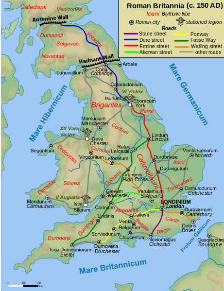
The roads in medieval Britain used London as the main hub.
After the Romans bugged out of England, most of the formal road building halted
in the medieval period, although there were exceptions. King Edward I tasked
Roger Mortimer to improve and widen the access to north Wales in 1278. It seems
good King Edward didn’t want to traipse about on deer trails during his welsh
campaign.
Roads were often named according to the local economy: for
example, communities depending upon the salt trade had wiche as part of the town name. Accordingly, the roads were named
with along the same lines. In the book Medieval
Roads and Tracks, Paul Hindle explains:
“These roads were not specifically constructed for these
uses but were names for the type of traffic which often used them. The roads
leading from the inland salt towns (wiches),
including Droitwich, Nantwich, Middlewich and Norwich, are well known, and
their courses can usually be traced by ‘salt’ place-names such as Saltersford
and Saltersgate.”
Portways marked
entries to markets or ports. One portway that existed back before the conquest stretched
from Northampton to Southampton via Oxford. A herepath was a route used by an army- the ‘here’ derived from Old
English for army. Hindle gives the Salisbury Way herepath, which starts in
Shastesbury via white Sheet Hill and Chiselbury to Salisbury. Other names from
ancient languages for roads include heol,
stretten, fford, and gate.
Churchways gave access to a church (forth
eglo, or freglos, in Wales). A corpse
road was a route to a parish church with a burial ground. Finally, pilgrim
routes for folk to travel to visit shrines were important roads.

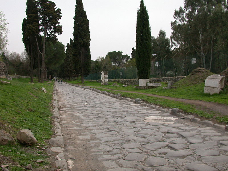
The above photo is of a herepath.

The members of the clergy logged many miles in their
attempts to spread the word of God. The medieval world boasted multiple
religious faiths and most of them sent out missionaries of sorts. In addition
to ministering to their flocks, members had to move supplies, messages, attend
meetings, and tend to farms, wineries or other properties. Many roads were
initially developed for the use of religious houses, such as the Abbot’s Way
which Buckfact Abbey with Tavistock and Buckland Abbeys.
Trade routes in the country gave rise to roads. One had to
bring livestock to market. Cattle didn’t do well on a boat. One could sheer a
sheep, and crate chickens, but try to convince a cow to hop on a boat. Oxen
were a mainstay of farmers for plowing fields, as horses were expensive to
feed. The drover roads meandered along fields, following paths livestock owners
would have used to get their animals to market. After the Black Plague killed an estimated 40% of the population of the country, the relationship between the traditional feudal lord and land-locked serf changed. There just weren’t enough workers left. The common folk became a valuable commodity and demanded changes. People had more of a say in their lives, earned more coin and even did more travelling.
The references used for this post included:
Medieval Roads and Tracks
By Paul Hindle
1982, Shire Publications, Botley, Oxford (UK)
ISBN #987-0-74780-390-4
Atlas of Medieval Britain
By Christopher Daniell
2008, Routledge, Abingdon, Oxon (UK)
ISBN#978-0-415-34069-4
Shaping Medieval Landscapes: Settlement, Society,
Environment
By Tom Williamson
2003, Windgatherer Press, Macclesfield, Cheshire (UK)
ISBN#0-9545575-8-1
Article with photographs on the recent discovery of an
ancient Roman road
Crystalinks: a website with more detail on Roman roads
Stay safe out there!
No comments:
Post a Comment